Salford City FC
Owned by the Class of 92 and backed by Peter Lim's money, Salford City went from non-league to the Football League in a decade. The Peninsula Stadium is small but smart.
Manchester area
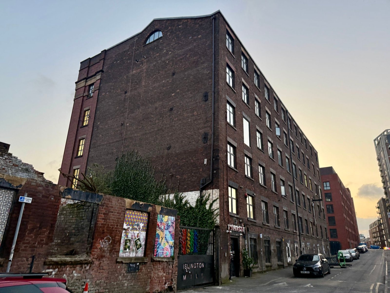
Salford is known today for the Georgian and Victorian core along Chapel Street, for Islington Mill's music, art and studio spaces inside a converted Victorian cotton mill, and for Peel Park and the University of Salford campus on the banks of the River Irwell opposite Manchester city centre.
Image: Islington Mill, Salford by Valienne (CC BY 4.0)
Salford is a city on the west bank of the River Irwell, immediately next to Manchester city centre, with evidence of settlement in the area going back 7,000 to 10,000 years. Its name comes from the Old English "Sealhford", meaning "ford by the willows". Ranulf de Blondeville granted Salford burgage status in 1230, making it a free borough with its own trading privileges, and by the late Middle Ages the surrounding area held more than 30 manor houses, including Ordsall Hall, a Grade I listed Tudor mansion whose oldest surviving parts date from the 15th century.
The Industrial Revolution transformed Salford: cotton mills lined the Irwell from the late 18th century, including Philips and Lee's Twist Mill of 1801, one of the earliest iron-framed multi-storey buildings in Britain. The Manchester Ship Canal opened in 1894 and turned Salford Docks into a major inland port employing over 3,000 people at its peak, and the city's population grew from around 12,000 in 1812 to 220,000 by the end of the century, packing people into overcrowded housing that Friedrich Engels, who studied conditions here, called "a very unhealthy, dirty and dilapidated district." The population fell sharply in the twentieth century, dropping 29 per cent between 1921 and 1939, and a 1931 survey found some of the worst slums in the country, prompting large-scale slum clearance from 1933 onward.
Chapel Street, running from the Irwell toward Salford Cathedral, remains the historic core of the city, and today mixes Georgian and Victorian buildings with newer developments; Salford Cathedral itself, a Roman Catholic neo-Gothic church, opened in 1848 to serve the area's growing Irish community. Islington Mill, a six-storey Georgian cotton mill at 1 James Street in Ordsall, now runs as an independent music venue, art studio and events space. The University of Salford's campus sits around Peel Park, with the Peel Building and the Working Class Movement Library nearby. Painter L.S. Lowry, known for his depictions of Salford's mills and streets, lived in nearby Pendlebury for 40 years, and his work is now the focus of The Lowry arts centre at Salford Quays, further along the Ship Canal toward MediaCityUK.
Written and last reviewed 10 Sep 2026 by Group CEO
Save the area, share a meeting point, or build a simple local loop from real places already on this page.
An orientation loop built from listings on this page, not live directions. Open each stop for current details.
Nothing here matches that. Clear the filters to see everything in Salford, or search the whole city.
Details checked between 20 Apr 2026 and 3 May 2026
A short list for now: only places checked against a real address are shown.
Owned by the Class of 92 and backed by Peter Lim's money, Salford City went from non-league to the Football League in a decade. The Peninsula Stadium is small but smart.
The Kings Arms on Bloom Street in Salford is a pub and small arts venue that has been a consistent presence on…
2 mapped locations in Salford
Schematic plot of the listed locations. It is not a street map and is not to scale.Open the full map
Background for getting your bearings in Salford.
Ranked by how much is listed in each, not by distance.
This page is short of an event, a place and a story for Salford. If you know one, add it and we will check it.
Nothing here opens a new form. Every link goes to a page the site already runs.
Optional analytics and advertising cookies, only with your consent. Cookie Policy (opens in a new tab)